Environment Canada has issued warnings and alerts for many areas of the province.

On the Avalon, rain is expected to begin Sunday morning and continue throughout the night into Monday. Environment Canada predicts total rainfall amounts between 30 and 60 mm by the time the rain tapers off on Monday morning.
Some higher amounts are possible, especially over westernmost sections of the Avalon from Goobies to Whitbourne. People traveling in the area are advised to check road reports for traffic disruptions before departing. High amounts are still possible over the eastern Avalon Peninsula, but at this time it appears the heaviest rain will fall on the western half where warnings are in effect.
Extremely heavy rain is expected in the Connaigre area. Rain, at times heavy, will persist through this evening before the rain tapers off later tonight into Monday morning. Torrential downpours at times may give rainfall rates near 15 mm per hour.
Environment Canada reports that further amounts of 70 to 100 mm are expected over most areas; however, some locations will receive totals in the range of 100 to 150 mm today and tonight. The heaviest rain will likely occur inland and over higher elevations, with portions of the Bay d'Espoir and Burin Peninsula Highways vulnerable to receiving some of the highest amounts.
Ensure storm drains are cleared from leaves and other debris prior to the onset of the heavy rain.
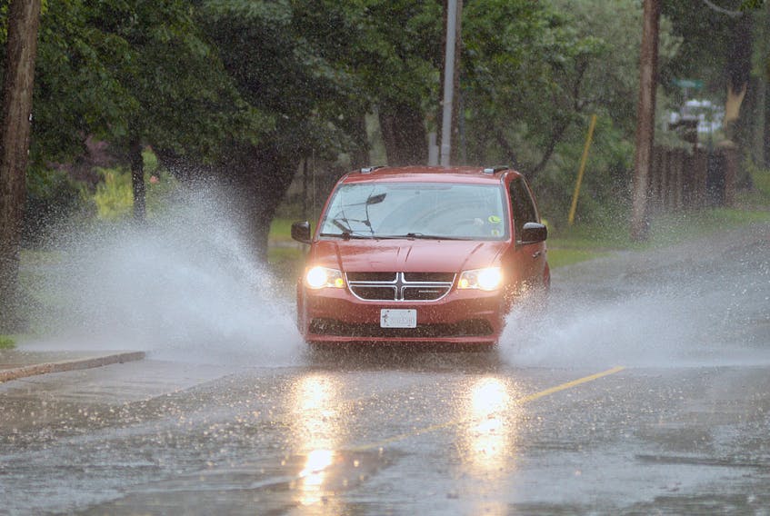
Motorists are advised to monitor road conditions. Heavy downpours can cause flash floods and water pooling on roads. Localized flooding in low-lying areas is possible.
The adverse weather conditions expected in Newfoundland and Labrador will likely affect travel plans tonight and tomorrow.
Marine Atlantic advises impending weather conditions have forced delays to the crossing schedules.
• Port aux Basques to North Sydney crossing is scheduled to depart Sunday morning at 11:45 a.m..
• North Sydney to Port aux Basques crossing is delayed until Sunday 11:45 p.m. or as soon as weather permits
Related links:
Environment Canada
https://weather.gc.ca/warnings/index_e.html?prov=nl
Provincial ferries
http://www.tw.gov.nl.ca/ferryservices/index.stm#
St. John’s International Airport
Marine Atlantic
http://www.marineatlantic.ca/en/Travel-Advisory/
Major Driving routes and Higway Cameras