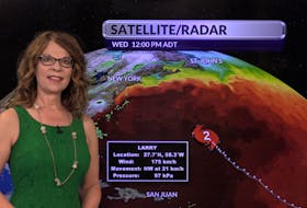
Earlier this week, there was talk out there of a nor’easter; I couldn’t see how it would be possible – given the placement of the systems. You see it’s all about location. Where the high- and low-pressure systems sit and how they feed either cold or warm air into developing waves of energy in the atmosphere, often define the storm. A nor’easter is a perfect example. Ideally, a blocking high over Quebec feeds cold air into a developing east-coast low. The storm forms along the coast as warm air clashes with arctic cold to the north and west. This week, the high was east of the Avalon.

The name is a contraction of the wind directions north and east. Over the years, many people have asked me why a nor’easter comes from the southwest? The direction in the name refers to the direction from which the wind is blowing as the storm rolls in. Yesterday, the wind blew from the east, the southeast and eventually the south. Today, the wind has come around to the southwest behind the departing low-pressure system. An eventual turn to the northwest will bring cooler temperatures for the early part of the weekend.
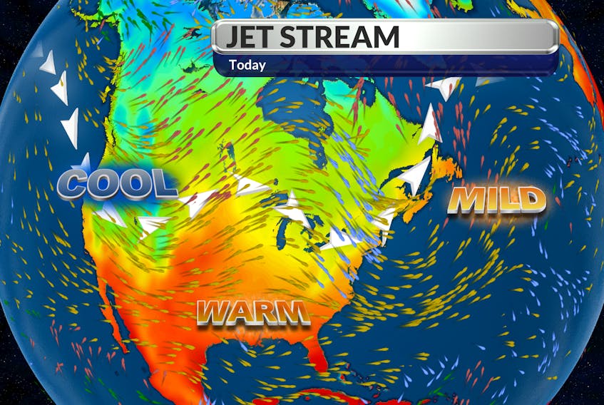
Overall, our temperatures are expected to stay near or even above seasonal values for a few more days, as the jet stream tracks north of our region.