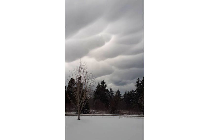
What a photo! You have to admit those are very impressive clouds. I have seen clouds like this before, but only in the summer or early fall. These clouds were spotted over Grand Manan Island, N.B., in February and I’m hearing now that many people did see them!
The clouds in the photo are mammatus clouds, also known as mammatocumulus. The name “mammatus” is derived from the word “mamma,” which means “breast” or “udder” in Latin. As you can see in the photo, they’re clouds that drift in with pouches at the bottom.
These clouds are commonly associated with severe weather, such as violent thunderstorms and tornadoes, but not always!
Mammatus clouds result from the sinking of moist air into dry air. For a mammatus cloud to form, the sinking air must be cooler than the air around it and have high liquid water or ice content. Mammatus clouds are long-lived if the sinking air contains large drops and snow crystals; the larger particles require greater amounts of energy for evaporation to occur. Over time, the cloud droplets do eventually evaporate and the mammatus clouds dissolve. So, if you think about it, mammatus clouds are upside-down clouds.
Because these ominous-looking clouds are not directly related to significant weather on the ground, mammatus clouds generally have been viewed as no more than a curiosity in the atmosphere. Curious but beautiful!
- Read more Weather University columns.
- Have a weather question, photo or drawing to share with Cindy Day? Email [email protected]
Cindy Day is the chief meteorologist for SaltWire Network.